03 Understand Geographic Information System (GIS) Infrastructure
PiriMap
Consolidate scattered map data into a single infrastructure. As the number of systems increases, it is not the number of maps that grows, but rather the common standard.
PiriMap is a product that meets the requirements for map visualisation, geographical analysis and data management in intelligence, command and control, maritime and disaster management systems, all within a single, platform-independent, standard GIS infrastructure.
- TUCBS-Compatible
- Platform-Independent (Linux – Windows – Solaris – macOS)
- Field-Proven
Map – 4 layers
Illustrative simulation
Loading layers: orthophoto, vector and elevation
01Layers. Orthophoto tiles, roads and buildings, and contour lines are loaded in turn. Once the elevation model is loaded, the flat map becomes three-dimensional.
How It Works
From data to sharing: four steps
Illustrative flow - 01 / 04
Multi-format vector, raster and elevation data are imported in bulk via GeoBoard.
Data is aligned to a single reference system through real-time conversion between different coordinate reference systems (WGS-84, MGRS, UTM, S-42).
Multi-layered maps, NATO symbology, LOS and viewshed analysis are displayed within the same environment.
It is distributed organisation-wide from the central map server via OGC-compliant WMS/WFS/WMTS services.
This arrangement is no coincidence; it is a natural consequence of the GeoBoard’s architecture
Problem
The problem is not the lack of map data; it is that every system draws its own map
Every application within the organisation — the intelligence system, the command and control screen, the maritime software, the disaster coordination centre — sets up its own geographical information system infrastructure separately. A map of the same region appears in different formats, with different coordinate references and different symbology across different systems.
Rather than reusing the existing map, each new application builds its own GIS layer from scratch. When different systems display the same area from different reference points, it is impossible to create a common operational picture; integration has to start from scratch every time.
This situation is not new; what is new is that the number of systems and the volume of data are growing much faster than before, driven by sensor technologies and autonomous platforms. The burden of this fragmented infrastructure, which seems acceptable today, becomes unmanageable by the time the next integration is required.
Developer / Integrator
For every new application, the GIS infrastructure is written from scratch; the same work is done over and over again.
Operator / Analyst
When using a different system, one has to learn a different interface and set of symbols; the margin for error increases.
In-house IT
A jumble of servers, formats and licences builds up; TUCBS compliance is tested separately for each system.
Organisation
The map of the same area remains inconsistent across systems; a common operational picture cannot be established.
Creating a map isn’t difficult; the difficult part is finding each other on the same map
Solution
A single mapping standard, a single data management system and a single integration point across the organisation
The architecture of the solution involves integrating map visualisation, geographical analysis, data management and symbology support within a single standardised infrastructure. Rather than developing their own GIS, applications are built on a shared backbone; this eliminates the question of which system uses which map.
Product
What is PiriMap?
PiriMap is the product that brings the architecture described in ‘The Solution’ to life: it has been developed within MilSOFT as a platform-independent SDK and map server infrastructure.
It is not comprised of a single component. The Desktop SDK (Java & .NET) and Web SDK (JavaScript), together with the PiriMap GeoBoard — a distributed, scalable data management and map server solution — form an integrated product family. Support for NATO symbology and military maritime data formats is not an afterthought compatibility layer, but rather the very foundation of the product.
PiriMap is not a general-purpose GIS visualisation tool. It forms the backbone of a single, organisation-wide mapping standard.
Capabilities
Platform-Independent Architecture
Support for Linux, Windows, Solaris and macOS; integration with both native and web applications via the desktop and JavaScript SDKs.
Goal: To ensure that the same infrastructure works in every environment, rather than developing separate solutions for each platform.
Multi-layer Map Viewing
2D/3D viewing of raster, vector and orthophoto layers; terrain, roads, buildings and military features are managed in separate layers.
Goal: Bringing together different types of data in a single environment, without any confusion.
Geospatial Analysis
Line of sight (LOS) and viewshed analysis; elevation profile extraction.
Goal: Converting the raw map into decision-support data.
NATO Symbology Support
A military symbology library compliant with the APP-6D, MS 76-2 and NTDS dictionaries.
Goal: To ensure a common symbolic language with allied systems.
OGC and Maritime Standards Compliance
Support for WMS/WFS/WMTS protocols; ARCS, S-57 and S-63 maritime data formats.
Goal: To connect to existing map servers and maritime platforms without an additional conversion layer.
Centralised Data Management (GeoBoard)
Distributed, scalable web-based data management; importing, styling, publishing.
Goal: To consolidate scattered servers and formatting issues into a single point.
The Difference
Why PiriMap?
When selecting a GIS infrastructure, the key question should not be ‘should a map be displayed?’, but rather ‘on which GIS infrastructure should it be built?’. Common weaknesses in this area include: reliance on third-party licences; military standard support being provided via an add-on compliance layer; and the map server being added as a separate cost item. PiriMap meets the same need through a different engineering and ownership model.
It ensures technological sovereignty.
Ownership of the source code; freedom to set up a local maintenance team; updates are not subject to authorisation from a third country.
The cost of ownership is transparent.
The map server (GeoBoard) and data management system have been developed in-house; there is no underlying licence stack.
It grows with the mission.
It starts as a map-viewing application, but the same infrastructure evolves into a multi-system GIS backbone across the organisation — with no need for further purchases.
It protects the existing investment.
Instead of scrapping existing systems, it integrates them into the picture using OGC-compliant services.
The standard is the starting point for architecture.
Support for NATO symbology and maritime data formats is not a layer added later, but forms the very foundation of the product.
It is field-proven.
It is actively used as infrastructure in intelligence, command and control, maritime and disaster management systems.
Use Cases
Command and Control (C2)
A map infrastructure for unit positioning, tactical symbology and operational planning; it supports data sharing between different forces on the same platform within a joint operations environment.
ISR Systems
An infrastructure for geographical data management and visualisation in intelligence, surveillance and reconnaissance applications.
Maritime Platforms
Viewing and managing ARCS, S-57 and S-63 formats; navigation and maritime operational area planning.
Disaster and Emergency Management
Disaster coordination, resource tracking and field management; an OGC-compliant service layer enables different organisations to share data on the same platform.
Technology and Standards
Architecture
- Software architecture
- Platform-independent SDK + Map Server (GeoBoard); modular component structure
- Desktop component
- PiriMap Desktop — Java & .NET (C#) SDK
- Web component
- PiriMap Web — JavaScript SDK
- Platform support
- Linux, Windows, Solaris, macOS + browser-independent web SDK
- Dependencies
- The map server and data management system have been developed in-house; there are no additional licence costs
Standards and Interoperability
- NATO symbology (APP-6B/C/D, MIL-STD 2525B/C/D, NTDS, S-52, AML)
- Available
- OGC geographic web services (WMS/WFS/WMTS)
- Available
- Maritime data formats (ARCS, S-57, S-63)
- Available
- Coordinate/projection transformation (WGS-84, MGRS, UTM, S-42)
- Available
- TUCBS compliance
- It has been designed to comply with the scope of the regulation
Who Is It For?
Decision-maker
A single mapping standard across the organisation; this eliminates the question of which system uses which map.
Developer / Integrator
Rather than writing a GIS system from scratch, it uses a ready-made SDK; a single platform for desktop, web and mobile.
Operator / Analyst
Layered maps, analysis and symbology all in a single environment; no need to learn different systems or interfaces.
In-house IT
A centralised data management and map presentation hub; putting an end to scattered servers and format chaos.
Organisation
Compliance with the TUCBS regulations, technological sovereignty, protected past investments.
Layer 03 - Understand
Related Solutions
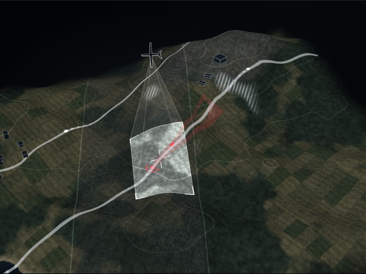 Understand Multi-Source Intelligence, Surveillance and Reconnaissance (ISR) Analysis and Situational Awareness Platform Vedra Vedra integrates images and video from UAVs, satellites, radar and electro-optical sensors into a single operational picture. Explore
 Command Combat Management System Mil-CMS A combat management system, developed entirely in Türkiye, which integrates all manned and unmanned assets across the air, land and sea domains into a single tactical picture. Explore
 Command Wide-Area Command and Control System WACCS WACCS is a web-based Wide Area Command and Control System developed by MilSOFT, which enables command centres operating in different locations to work using the same information flow, mission structure and operational view. Explore

Next Step
Not separate maps, but common ground
PiriMap is a platform-independent, TUCBS-compliant GIS backbone that does not require every application across the organisation to rewrite its own GIS. Starting with a single SDK component during the integration phase, the infrastructure evolves into a multi-system GIS backbone across the organisation — without the need for further purchases.
There are two ways to integrate PiriMap into your own architecture:
- 01 Technical assessment package Product documentation, table of standards and sample integration scenario.
- 02 Architecture workshop A half-day joint assessment of your current system architecture.